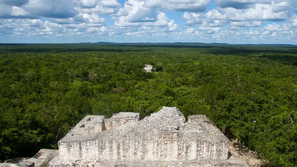
In 2024, a Mayan megacity was discovered in Campeche, Mexico. Swallowed by the rainforest, this lost urban center contained pyramids, plazas, amphitheaters, and highways. But this discovery wasn’t made by a team of seasoned explorers hacking through the rainforest with machetes. It was made by a Ph.D. student. And he found it by accident.
“I was on something like page 16 of a Google search and found a laser survey done by a Mexican organization for environmental monitoring,” Luke Auld-Thomas, who is pursuing his doctorate at Tulane University, explained to the BBC in October. That overlooked, decade-old survey contained groundbreaking information hidden in plain sight.
The survey used light detection and ranging (lidar) technology, a remote-sensing method that sends thousands of laser pulses from an aircraft to map objects buried beneath vegetation. The system measures how long it takes for the signals to bounce back, creating a detailed 3D image of the landscape.
Now named Valeriana, this lost metropolis is believed to be one of the densest Mayan cities ever discovered. At its peak (between 740 and 850 A.D.), it may have housed anywhere from 30,000 to 50,000 people—more than the region’s population today. Over 6,000 buildings were identified, ranging from homes to towering pyramids. “The larger of Valeriana’s two monumental precincts has all the hallmarks of a classic Mayan political capital: enclosed plazas connected by a broad causeway; temple pyramids; a ball court; a reservoir formed by damming an arroyo (a seasonal watercourse),” said Auld-Thomas in findings published in the journal Antiquity.
Lidar is revolutionizing archeology, allowing researchers to peer through thick rainforest canopies without setting foot in the jungle. The technology has helped identify hundreds of thousands of structures in Mayan cities across southern Mexico and northern Guatemala.
More than just revealing lost cities, these findings challenge a long-held belief that the Maya civilization was composed mainly of small, isolated villages. Lidar has instead uncovered a vast, interconnected network of cities, roads, and infrastructure, suggesting an advanced society with extensive trade routes and economic cooperation.
Lidar also revealed parts of an extensive network of elevated highways—massive causeways built centuries before modern roads. Some stretched up to 131 feet wide, connecting cities across vast distances. “They’re the world’s first superhighway system that we have,” said Richard D. Hansen, an archeologist and now an adjunct professor of anthropology at the University of Utah.
These long-distance trade routes “can be traced by following the cities that were interacting and exchanging not only goods but also ideas,” says Christa Schieber de Lavarreda, head of the Tak’alik Ab’aj National Archaeological Park in Guatemala.
One such route stretched from Tabasco in the Gulf of Mexico, winding through Tehuantepec and Chiapas, continuing along the Pacific Coast of Guatemala, and reaching as far as El Salvador. According to Schieber, “These routes, which operated for centuries, can be compared to the Silk Road during the time of the Roman Empire.”
But trade wasn’t just about moving goods from one city to another. “There are also ‘invisible’ traces of raw materials used in products that combine multiple components—some sourced from different locations than the place of production,” Schieber explains. “These traces reveal an entire chaîne opératoire (production chain) involved in creating the final product.”
One example comes from jade production in Guatemala. Archeological evidence from Cancuén suggests that raw jade was transported hundreds of kilometers to be processed into “pre-forms”—partially worked pieces that were then exported somewhere else for refinement. Cancuén wasn’t just a city, but a hub in a broader regional trade network, where valuable materials were moved and transformed before reaching their final destinations.
The discoveries are reshaping our understanding of the Maya civilization. Settlements once thought to be regional capitals have been revealed as mere suburbs of even larger metropolises. What seemed like natural hills have turned out to be long-lost pyramids. Ravines have been identified as remnants of ancient human-made structures. And what was considered simple trade has emerged as a far-reaching import/export system.
Yet these findings only hint at the full scale. The vastness of Mayan cities, the sophistication of their infrastructure, and the complexity of their trade networks suggest that much of their world remains hidden beneath centuries of overgrowth. As researchers continue scanning unexplored regions, they expect to find even more lost cities, rewriting what we know about one of premodern history’s most advanced civilizations.
This article originally appeared in print under the headline “Lost Cities in the Jungle.”